
There are many uses for
building information models that are yet to be discovered. One Finnish team
collaborated with a city and fire & rescue authority to explore how BIM
would help make buildings safer.
“Imagine a fire inspector in a building with an AR headset. He can retrieve
data from the building’s digital model and hence get an x-ray view of the pipes
and cables behind the lowered ceiling.”

That’s a scenario that Timo
Lehtoviita pictured when we discussed the experimentation project which he
led at Saimia, Saimaa University
of Applied Sciences.
Saimia, the city of Lappeenranta and their real estate
company LATO, and the Rescue Department of South Karelia partnered in 2018 to
explore the possibilities of using BIM to make buildings safer. The project,
titled “Enhancing building safety using information models,” formed part of the
national KIRA-digi built environment digitalization program.
From Drawings to BIMs
Fire and
rescue authorities hold paper drawings, or sometimes pdf files, of buildings
for inspection and firefighting purposes. At least in Finland, rescue authorities
are not familiar with the use of building information modeling in this context.
Digital
models can contain much more information than two-dimensional drawings,
including a three-dimensional representation of a building. With BIM, the
authorities would get a more comprehensive view of the facility they’re
inspecting or rescuing. That would save time, improve the quality of
operations, and even save lives.
The city of Lappeenranta in southeastern Finland is a forerunner in
utilizing building information modeling. The city has corporatized its real estate
functions into LATO, which provides facilities for the city and SMEs in the
area. LATO requires that all the building projects that they commission must
use BIM and provide models in an open IFC format. After project completion, the
models become the property of the city.
Lappeenranta
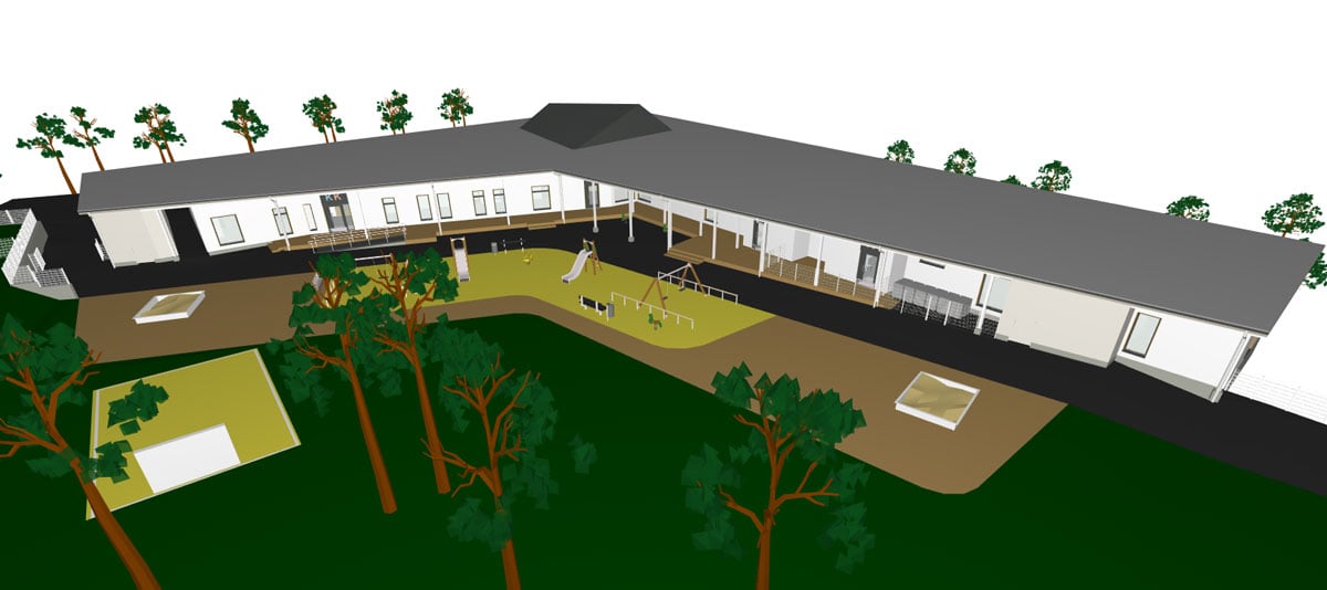
offered experimentation models from three construction projects: a daycare
center, a fire station, and a sports hall. The models were transferred in a vendor-neutral
IFC format.
The Three Use Cases
The project
studied three use cases for BIM: planning permission, inspections, and rescue
operations. The last mentioned was studied at a concept level.
The
benefits of BIM at the planning permission stage were obvious. The authorities need
to inspect the plans to ensure they satisfy fire codes. They want to know how
the building is compartmentalized, where the exits are, and where the fire protection
devices are located. That’s far easier to do with a 3D model, with searchable
data and physically realistic representation, than on a 2D drawing.
“The test
immediately convinced the rescue authorities. From now on, they are committed
to using BIM for compliancy checking in Lappeenranta,” says Lehtoviita.
Three-dimensional
models also help facilitate inspections during and after construction, too. The
experimenters tested the Microsoft HoloLens to visualize, in situ, how
real-life and digital information can be combined and utilized.
Fires and chemical
accidents are the most extreme scenarios to which BIM would add value. At the
very beginning of the rescue operation, the rescuers can learn about the
building, its spaces, and the placement of fire detectors, extinguishers, and
other related equipment. Firefighters with AR gear are also able to navigate themselves
inside the building, even in limited visibility.
In addition
to the use cases, the project touched on the documentation that fire
departments need in cases of emergency. In Finland, buildings with an automatic
fire alarm system must provide a special document—a so-called target
card—that contains a schematic plan of the building and information about the
fire protection systems. The project tested how the target card could be reconfigured
as a BIM model.
Making BIMs More Useful
for Rescue Purposes
Building
information models are created and used mainly by professionals: architects,
engineers, and managers on construction sites. The user interfaces of the
modeling software are intimidating for occasional users.
“Our
criteria for selecting the BIM tools were that they would read IFC files, be
lightweight and intuitive, and have a user interface in Finnish,” Lehtoviita
points out. “As always, we did not find one tool that would be perfect in all
aspects. We ended up testing Solibri Model Viewer, Trimble Connect, and Dalux
Build.”
The project
team soon realized that some information for rescue purposes was missing from
the BIMs that they received. The national common BIM requirements used by
Lappeenranta did not specify the rescue-related data adequately.
That find inspired
the project participants to create an extension to the current common BIM
requirements. They have shared their suggested additions with buildingSMART
Finland, the organization that coordinates the updates nationally.
“We propose
that all the authorities should collaborate during the planning permission
process with BIM,” says Lehtoviita. “In fact, we’ve created project flowcharts
showing how to do it. In all, the results of this project are a good basis for
further development for cities and tech companies.”
To learn more about the project, contact Timo
Lehtoviita at .
Title photo: Tuomas Pylkkänen, preparedness chief at the Rescue Department of South Karelia is testing an AR headset.